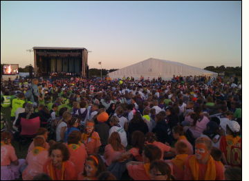
At the beginning of August I attended the Essex International Jamboree in Thorpe-le-Soken. This photograph was taken at the closing ceremony using my Apple iPhone 3G. This device has a built-in GPS receiver and is able to determine the exact position for latitude and longitude whenever required.
Usefully, location information is made available to the camera application when taking photographs with the iPhone. The latitude and longitude information is stored in the photograph's EXIF header within the file.
Using Yahoo Map's API, the EXIF data can be read and once interpreted, a location pointer can be layered on a given map.
Ultimately this means that viewing sets of photographs can be location specific. Imagine browsing your library of photographs by location. Using a map of the world I could easily find my photographs scattered in far away places including New Zealand, Thailand, Caribbean, and America.
Of course, this isn't new technology as such. Placing photographs on a map has been achievable for some years and the process of 'geotagging' images with location data is well understood by many. What the iPhone does is make geotagging very straightforward as all the location information is stored automatically at the point of taking the photograph. All that's required now is for a piece of software that can interact with the mapping API to do the rest.
With a little bit of work I was able to develop a little module that allows the location of geotagged photographs to be displayed on a map. So you kinda get a "I was 'ere" tool that shows exactly where you were standing when the photograph was taken. Unfortunately, this uses Yahoo Maps rather than the very impressive Google Maps interface - but hey, nothing is perfect.
...oh, and to see the map you'll have to view the full blog entry.